North Mayo Drive and Beaches
Best Beaches Wild Atlantic Way, Best Drive Wild Atlantic Way, What to see and Do North Mayo.
The rugged wild windy coast of North Mayo is remote, unspoilt and beautiful with a loop drive from Ballina or further along the north-west coast to the Mullet Peninsula or south-west towards Achill. The area has few shops or facilities so if you plan to spend a day driving through the area you might want to bring food with you. There are many stunning picnic spots and some beaches, not all of which are suited to swimming due to the strong currents and waves.
If you drive the North Mayo coast from Ballina without stopping the loop drive will take 4 hours, but with so much to see and photograph you will want to stop, if only at the sea stack of Dun Bríste or the Ceide Fields. North Mayo is covered by blanket bog down to the coast and the roads are bumpy and slow, so there’s little point in rushing the drive. We expect Joe Biden to visit his ancestral home of Ballina again in the next few years, and see the land his ancestors left behind.
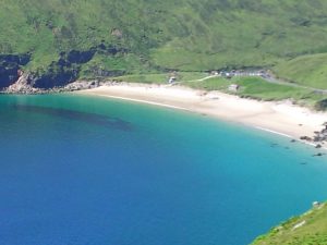
The beaches to the west coast of Mayo on Mullet Peninsula and Achill Island are stunning with many almost empty sandy strands. To the south of Westport are more Blue Flag beaches with a ferry service operating to Clare Island in Clew Bay. There are no wheelchair buggies in Co Mayo but the Co Council provides access via ramps at some beaches.
Start the drive from Ballina along the unspoilt North Mayo coast. The route from Killala Bay to Benwee Head is about 60km long on bumpy roads and there is much to see. Modern family homes, older farmsteads and run-down old houses dot the landscape. The route crosses peat bogland so needs to be taken slowly. Bring cash as this is an area with very few banks or ATM machines. It’s off the grid, the phone signal is intermittent and the wifi is poor.
Details of the beaches of Mayo have been listed along with some striking landscape or places to visit in Mayo under the following headings:-
-
Beaches of Mayo Beaches North Coast of Mayo
-
Beaches Mullet Peninsula
-
Beaches Achill Island
-
Beaches south of Westport
Beaches North Mayo Coast.
1.Killala
Lat 54.232, Long 09.2590
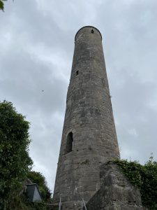
Killala village on the north Mayo coast on R314 is colourful with Ross Beach to the west. Stop to see the round tower in a cluster of village buildings just off the main street. Ross beach is a long sandy beach with lifeguards on duty from June to August. The beach is one of the Blue Flag beaches of Mayo with safe swimming and a long sandy strand. The view of Bartra Island and Enniscrone village across the Moy Estuary is spectacular.
Killala village on the north Mayo coast on R314 is colourful with Ross Beach to the west. Stop to see the round tower in a cluster of village buildings just off the main street. Ross beach is a long sandy beach 5km north of Killala.. The beach is one of the Blue Flag beaches of Mayo with a long sandy strand, safe swimming and lifeguards on duty from June to August. The beach is one of the Blue Flag beaches of Mayo with safe swimming and a long sandy strand. The view of Bartra Island and Enniscrone village across the Moy Estuary is spectacular. Killala Bay is an extensive triangular estuary with mudflats lining the sides of the channel. The bay offers rich feeding for wildfowl and waders. An esker ridge close by is covered by hazel woodland. The ground flora here has an unusual degree of diversity. Bring a picnic. Toilets are beside the beach.
Loop Walk – Take a 5km loop walk along the coast when the tide is out, past the coastguard station, CBI Beach Killala (a small secret gem, but not safe for swimming) and back to your starting point. Only do it as the tide is going out.
2. Lacken Strand
GPS Lat 54.2740, Long-9.2590
On the smaller coast road from Killala towards Downpatrick Head on an inlet from the sea is a long sandy beach when the tide is out. This is a spectacular bay great for walking around but not safe for swimming due to currents.
3. Ballycastle Beach
GPS. Lat 54.3257, Long 09.78466
This beach near Ballycastle, the Ceide Fields and Downpatrick Head is a small sandy beach at Banatrahir Bay. Ask the locals about the Mermaid’s Fin which can appear when the tide goes out. Ballycastle is one of those Irish towns with many pubs and a few cafes. Call into Mary’s Country Kitchen for great local seafood.
Downpatrick Head
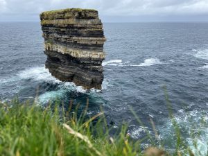
Take a turn to the sea off the main road (signposted) at Ballycastle, along narrow lanes for 3-5km and you will come to Downpatrick Head. Dún Briste is a sea stack off the coast and the cliffs here are taller than the Cliffs of Moher. A storm snapped what is now a sea stack away from the mainland in 1393 and it looks like a skyscraper in the sea with waves crashing around it. Walk to the top of the hill to get the best views of Sligo Bay, the stags of Broadhaven Bay, a wild untamed coastal landscape. At the top of the headland, you will see the Éire 64 coastal marker composed of stones painted white during World War 2 to advise Allied planes that they were approaching Ireland.
There is an enormous blowhole fed by caves in the sea below called Poll na Seachtaine and whips of sea mist constantly emerge from the hole. It’s a great place for a walk to clear the head.
Ceide Fields Interpretative Centre
This hillside is covered in blanket bog, stone-walled fields and heather. In the 1930s a man cutting turf noticed the stone road built 5,000 years ago, in the Neolithic era, by simple farmers.
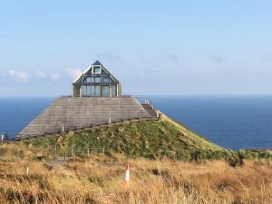
Overlooking the sea on the R314 is the Ceide Fields Interpretative Centre, managed by the OPW. This very modern building is sunk into the landscape with only the glass tip on view. The centre tells of the people who lived here, what they ate and how they farmed 5000 years ago. It is the most extensive Stone Age monument in the world. A small section of the site was excavated in the past 25 years, but much of the ancient road and stone walls are still under the bog.
Park in the car park and take a selfie of yourself from across the road. The Dún Briste Sea stack will be visible over your shoulder and it is a great place for a selfie with the cliffs of Downpatrick Head behind you.
Benwee Head
At Belderrig take a turn off the main road along the coast to Benwee Head along a narrow bumpy bog road. You’ll see turf stacked to dry on the bog, bags of turf waiting to be taken home or stacks of it close to peoples’ homes. You’ll also see sheep wandering the roads.
4. Kilcummin Strand
GPS. Lat 54.2775, Long 09.2317
Kilcummin Strand is signposted from the R314 at Lacken. Suited to walking or sea angling and you will see people arriving for a days fishing. This beach is not suited to swimming. This is where General Humbert landed in 1798 and has a long empty sandy beach.
5. Portacloy
GPS Lat 54.3257, Long 09.7846
This isolated beach near Carrowteige Cove has blanket bog stretching down to the sea. This beach is great for swimming and snorkelling. Bring a picnic, drinks and snacks or call into Teach Greannaí in Carrowteige. Lovely Portacloy 18km loop walk starts at the beach. This area is a Gaeltacht (Irish speaking area and the language of the community)
Take the inland road ( R314) back to Ballina or continue to the wild Mullet Peninsula with Belmullet town, and along the Wild Atlantic Way.
Mullet Peninsula.
The Mullet Peninsula west of Belmullet is a wild exposed landscape
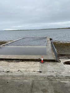
with long beautiful beaches.
6. Mullaghroe Beach
GPS. Lat 54.1430, Long 10.0700
At Blacksod Bay is a 900 m long sandy sheltered Blue Flag beach with dunes, salt marshes and a breeding ground for birds. To the east of the beach the dunes are so tall they have formed cliffs. No lifeguards.
7. Elly Bay
On the Mullet Peninsula, 9km south of Belmullet is Ely beach on the R313. The sandy beach has a Blue Flag and is great for swimming and water sports. Access for disabled people but no facilities. The bay is internationally important for its ecology and birdlife.
Achill Island Beaches
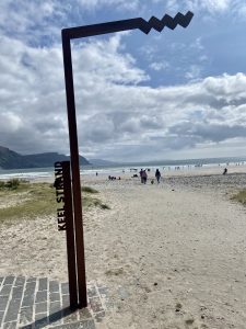
South of Belmullet, across the bogs on R313, then the N59 past Ballycroy National Park. The bridge to Ireland’s largest island, Achill, is well signposted off the N 59. Achill Island has 4 beaches of renown and the highest cliffs in Europe. Achill is about 1 hours drive from Belmullet and 40 minutes drive from Westport. The Great Western Greenway stretches from Westport to Achill Sound and can be walked or cycled. Ballycroy National Park and wild Nephin is just above Achill. The beaches of Achill are all sandy and welcoming
8 Doonega Beach
Is on the northern side of the island on a small coastal inlet. This blue flag beach has an access ramp for disabled people, though no disabled toilets and does not have a lifeguard in summer. Suited to swimming with a ramp for disabled access.
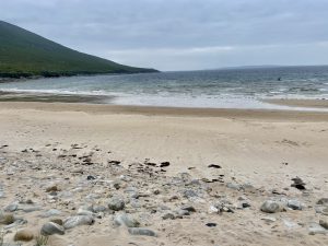
9 Golden Strand at Dugort
GPS Lat 54.01227 Long 10.0177
This beach is 3km east of Dugort village, the 2.3km beach has some stone as well as sand below the high tide mark and rocks and stones on the upper shore. With a lifeguard in summer this Blue Flag beach is on a semi-exposed site.
10 Keel Beach Achill
GPS Lat 53.97185, Long 10.0736
In the village of Keel 7km from Achill Sound on the island is a stunning 1km long sandy south facing beach. Turn left from the main road R319 and the beach is 200 meters in front of you, with a long car park behind the dunes. The Blue Flag beach is great for walking, swimming and water sports but has no disabled facilities. Lifeguard in summer and easy access from the car park to the beach for disabled users. Food and drinks are available in the village but it’s one of those beaches made for picnicking on.
11 Keem Beach Achill
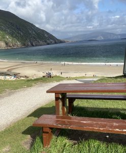
GPS. Lat 53.9666 Long -10.1936
Drive or cycle the full length of Achill Island until the road goes no further west! Keem beach is 17 km west of the bridge at Achill Sound and described by Lonely Planet as one of Europe’s best beaches. ‘This half-moon bay of golden sand at the foot of steep cliffs and grassy slopes. Basking sharks are sometimes sighted offshore.
Keem beach is a small jewel of a beach 300m long down the winding lane, with car parks and notice boards on each bend. You can turn at the car park by the beach, and you may have to park at one of the upper car parks. There is a ramp for disabled people to access the water but no disabled toilet facilities. With the highest cliffs in Europe to the western end of the island this sheltered east-facing beach is a gem. A lifeguard is on duty in summer and there are lots of sheep in the area. It can get very congested in high summer. The drive to this beach at sunset is magical as the sun sets dramatically to the west.
12. Mulranny Beach
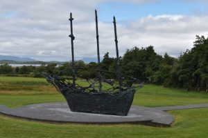
GPS. Lat 53.8999 Long 09.7759
This popular Blue Flag beach is south-west of Mulranny village signposted from the R319 and north of Westport Town on the R59. Near the North-Western Greenway route so you can cycle from Westport or Achill sound. The beach is 370m long with stone at the upper beach and a sandy beach at mid to low tide. There is no disabled toilet but there is an access ramp to the sea.
Beaches south of Westport
The area south-west of Westport along the coast is a designated an Area of Outstanding Natural Beauty with the town of Louisburgh as the focal point. Drive the Atlantic coast where blanket bogs stretch from the mountain landscape with Croagh Patrick as the highest point. Climb Croagh Patrick during the summer months and the last Sunday of July is called Reek Sunday when the pilgrimage climb attracts thousands and mass is celebrated at the top. We recommend climbing Croagh Patrick any time but that Sunday if you want to avoid crowds.
13. Bertra Beach
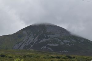
GPS Lat 53.7891, Long 09.6586
Bertra Blue Flag beach (Barr Trá in Irish) near the village of Murrisk 12 km south-west of Westport on the R335 is suited to families. The Irish name Barr Trá means the ‘top of the beach’ and it’s on a narrow neck of land forming a link to a previously offshore island. As the beach is over 1km long it is great for walking, with a 4 km peninsula walk along the headland. Like Mulranny Beach there are stones at the high tide mark below the dunes and a long sandy safe beach below the high tide mark. A lifeguard is on duty in summer, there is an access ramp but no disabled facilities. Great views of Croagh Patrick from the beach area. This beach lost its Blue Flag status in 2021.
14. Carrowmore Beach
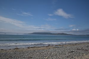
GPS Lat 53.7696 Long 09.8211
Carrowmore Beach beach 25km south of Westport on the R335 is 1km from Louisburg. Set on a rocky outcrop of Clew Bay the sandy beach is almost 1km long. Great for swimming and water sports with a lifeguard on patrol in summer. Access for disabled, but no other facilities.
15. Clare Island
GPS. Lat 53.7999 Long 09.9511
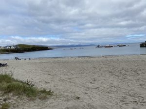
Take the ferry off the south Mayo Coast to Clare Island from Roonagh Pier, which is 7km south of Louisburg or 22 km from Westport (on inland route). The island is one of the inhabited Wild Atlantic Way islands and the beach is on either side of the island pier. The Blue Flag sandy beach is 1/2 km long and suited to swimming and water sports. The island is great for walking. Food available at the pub by the pier. At the top of the pier is Granuaile Castle, once the property of 16th Century pirate queen Grace O’Malley.
Contact us with any comments on this post- we love recommendations. Guided tours for individuals and groups can be organised in Co Mayo - contact ActivityDays.ie.

Leave a Reply
You must be logged in to post a comment.